Google+

Transportation

Street closures, bus routes and cheer zones: Getting around on Marathon Sunday

November 15, 2013

Photo by Jim McWilliams, Philadelphia Marathon.

Photo by Jim McWilliams, Philadelphia Marathon.

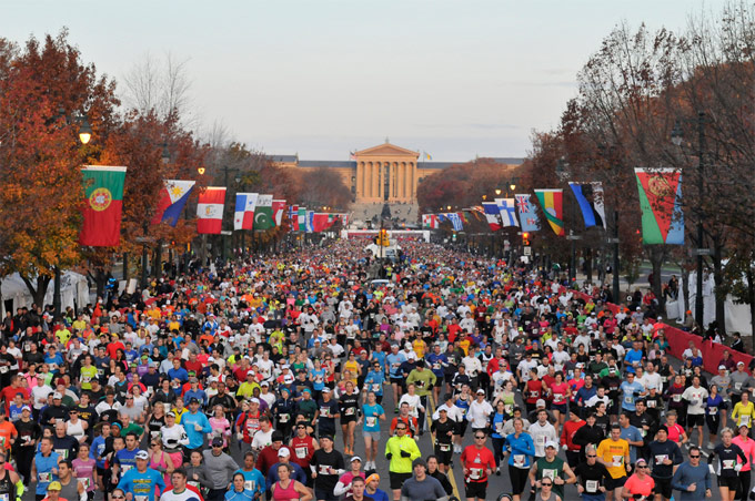
The Philadelphia Marathon is this Sunday and that means you need to be on your toes if you’re trying to get around the city that morning (an additional 150,000 or so people are expected to come into the city beginning at about 5 a.m.). The main race starts at 7 a.m. at 22nd and Ben Franklin Parkway and we have compiled some information below on street closures, changes in SEPTA routes and places to watch the race.

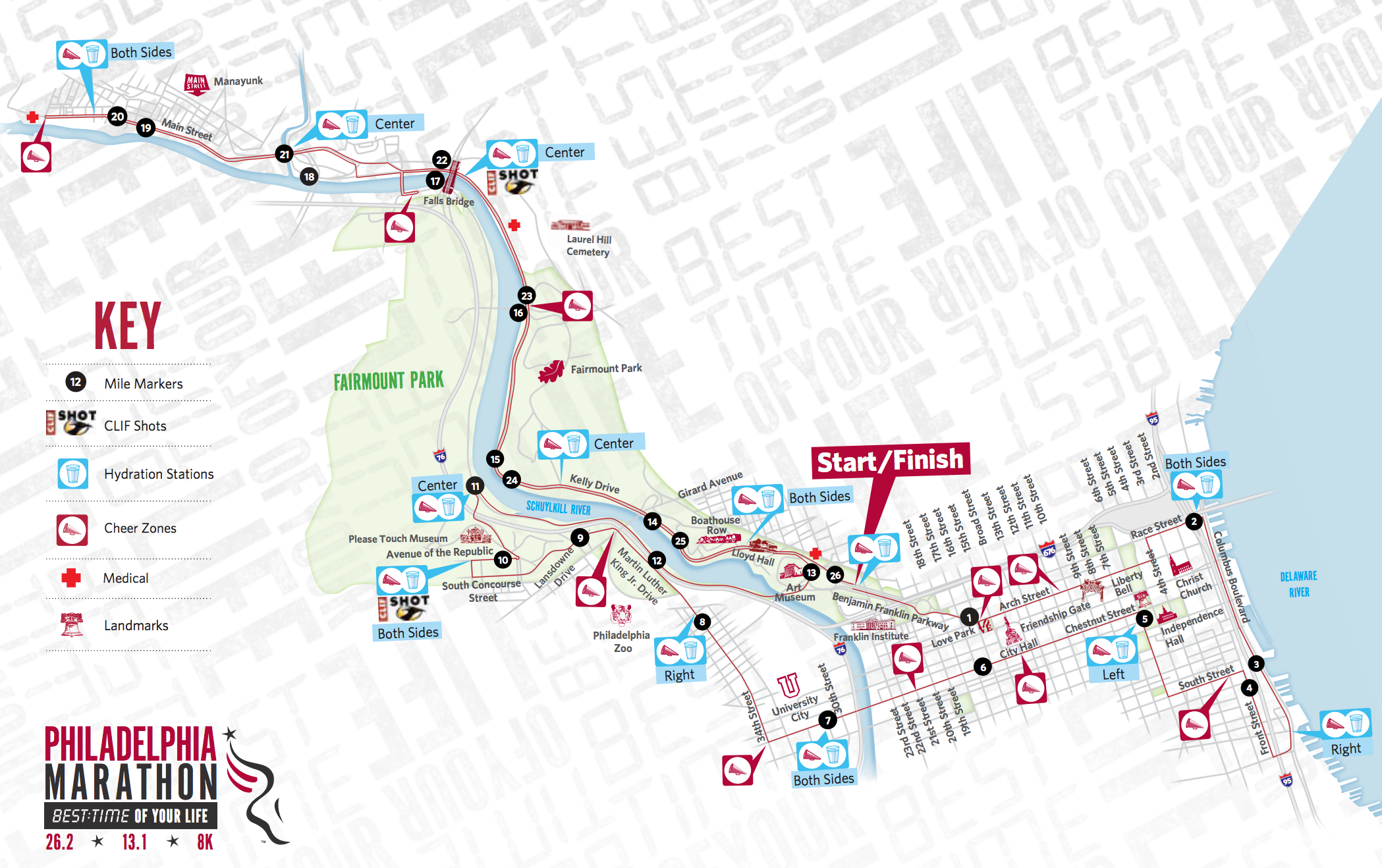
The race route enters West Philly along Chestnut Street before hooking a right on 34th Street and proceeding to Fairmount Park. The race winds through the park near the Please Touch Museum before connecting with Martin Luther King Drive and following the river before turning back toward the Art Museum. The 6-mile West Philly section are miles 7 through 13 on the 26-mile course. See below for the exact route, “cheer zone” spots and approximate times runners will be blowing through.

Public transit routes will be impacted and some some streets will be closed. Bus routes that cross the marathon route will be rerouted from about 4:30 a.m. until, in some cases, early evening, according to SEPTA. Here is a list of bus routes that will be changed, including buses 21 and 42. If you need to get to Center City or thereabouts on Sunday your best bet in most cases will be the Market-Frankford line.

The city also says it will enforce “no parking” regulations along the race route and will begin towing violators early Sunday morning. Look for signs.

Some of the major areas impacted include:

– The inner lanes of the Benjamin Franklin Parkway on Friday, November 15 through Sunday, November 17.
– Citywide along the 26.2-mile route of the Philadelphia Marathon on Sunday, November 17.

The following streets will be closed at 6:45 a.m. on Sunday, Nov. 17, and will reopen, as runners pass through the race course. All race routes will remain closed until 4 p.m. (Taken from the marathon website.)

• 21st Street, from Spring Garden to Arch streets
• 22nd Street, from Spring Garden to Arch streets
• Benjamin Franklin Parkway, from 22nd to 16th streets
• Arch Street between 16th to 4th streets
• 4th Street Arch to Vine streets
• Race Street, from 4th Street to Columbus Boulevard
• Columbus Boulevard (Southbound lanes), Vine Street to Washington Avenue
• Southbound off-ramp, from I-95 at Washington Avenue
• Washington Avenue, from Columbus Boulevard to Front Street
• Front Street, from Washington Avenue to South Street
• South Street, Front to 6th streets
• 6th Street, Bainbridge to Market streets
• Chestnut Street, 6th to 34th streets
• 34th Street, Chestnut Street to Girard Avenue
• Lansdowne Drive, Girard Avenue to South Concourse Drive
• South Concourse Drive, Lansdowne Drive to West Memorial Hall Drive
• West Memorial Hall Drive, South Concourse to Avenue of the Republic
• Avenue of the Republic, West Memorial Hall Drive to Centennial Circle
• Old Lansdowne Drive to the Sweetbriar Loop
• East on Black Road to Martin Luther King Drive
• Martin Luther King Drive
• North on Kelly Drive to the Falls Bridge
• The Falls Bridge
• Ridge Avenue, Schoolhouse Lane to Manayunk Avenue
• Main Street, Ridge Avenue to Green Lane.

Here are a list of the “cheer zones” (places to watch the race that include some sponsored zaniness) on this side of the Schuylkill:

• Wawa Cheer Zone, 34th & Chestnut Streets—Mile 7.5 (7:10 a.m.-9:15 a.m.)

• 34th Street & Fairmount Avenue—Mile 8.3 (7:15 a.m.-9:30 a.m.)

• Kids Cheer Zone, 34th Street & Girard Avenue @ the Philadelphia Zoo—Mile 8.5 (7:15 a.m.-9:30 a.m.) J

• West Memorial Hall Drive near Please Touch Museum—Mile 9.8 (7:15 a.m.-9:45 a.m.)

Course Turnaround at Martin Luther King, Jr. Drive & Black Road—Mile 11.1 (7:20 a.m.-10:00 a.m.) A runner’s favorite, the Vaudevillians NYB return again for a wild and quirky time to keep runners going as half marathoners are almost to the finish line and the full marathoners are getting into the groove.

The Philadelphia Marathon route (from the official website). Click to enlarge:

Screen Shot 2013-11-15 at 9.07.48 AM

Comments (1)

SEPTA gets more WiFi and an app

October 30, 2013

photo

SEPTA announced this week that it is expanding wireless service to many more stations, including most along the Market-Frankford and Broad Street lines. Today SEPTA launched free WiFi access at the 69th Street Transportation Center used by thousands of people every day.

SEPTA is partnering with Comcast on this thing (in exchange for some free advertising), so the WiFi is Xfinity. People who already subscribe to Xfinity just need to log in as usual. Non-subscribers should click on the Xfinity network on their device and follow the prompts.

Other stations where you can use WiFi include Market East, Suburban, 30th Street, Temple University, and University City. The rollout of free WiFi at all the stations on the El and Broad Street lines will take up to two years, according to a press release. WiFi will also be expanded to regional rail and airport train stations. It seems like it won’t, unfortunately, be onboard trains and buses. That’s OK, SEPTA has bigger fish to fry – like making sure it actually stays in business.

SEPTA also announced the release of a new app. It is pretty good, but it doesn’t go much further than the better third-party transit apps available (though it looks better). The app includes current schedules for all trains, trolleys and buses and up-to-the-minute info on regional rail. Using GPS, it will also list the closest stops etc. One not-so-intuitive thing is that when you want to return to the main menu of transit options, click the transit symbol (the trolley, bus, or train) in the upper left part of the screen (see screen shot).

The app is only available for the iPhone as of today, but we’re told that an Android version is in the works.

Mike Lyons

Comments (2)

University Avenue Bridge to be closed on Saturday, Oct 26

October 24, 2013

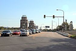
UniversityAvenueBridgeThe University Avenue Drawbridge over the Schuylkill River will be closed for maintenance work to all traffic from approximately 7:00 a.m. until 3:00 p.m. on Saturday, Oct. 26, according to an announcement by the Philadelphia Streets Department. Motorists are advised to use alternate Schuylkill River crossings, including Gray’s Ferry Avenue to the south and the Schuylkill Expressway and South Street Bridge to the north. Since this is a short-term closure, no detours will be posted in the area.

Here’s what you should expect during this temporary closure:

Northbound traffic on University Avenue will be stopped at Gray’s Ferry Avenue. Southbound traffic will be stopped at the entrance to the westbound Schuylkill Expressway. The eastbound Schuylkill Expressway ramp will remain open – but traffic exiting on this ramp will not be permitted to travel southbound on University Avenue. Pedestrian and bicycle traffic will also be impacted by this closure.

The four-lane bridge links University Avenue in West Philly with South 34th Street in the Grays Ferry section of South Philadelphia.

Comments (0)

Own a business or property in West Philly? Host a bike share station

September 30, 2013

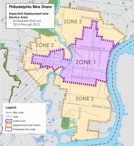
Philly Bikeshare mapAs West Philly Local reported earlier this year, a new form of public transportation in Philly – a bike share program – is scheduled to launch in 2014. The program will bring hundreds of bikes to the city for everyone to share (between 1,000 and 1,500 bikes will be included in Zone 1; see map). Currently, the Mayor’s Office of Transportation and Utilities is looking for property and business owners interested in hosting or sponsoring a bike share station. The City of Philadelphia requests letters of interest from interested business and property owners and institutions. The deadline to express this non-binding interest is Monday, Oct 7.

Here’s some more info if you want to be part of this exciting new program:

The City is looking for two types of partners:

Station hosts: Property owners willing to locate bike sharing stations on or near their property will be among the first round of sites considered for the system launch. Bike share stations require a minimum space of approximately 7 feet by 35 feet (235 sq. ft.)

Station sponsors: Businesses, property owners and institutions who would like to assure their participation in bike sharing from the outset are invited to become Station Sponsors. Sponsors will be at the top of the list for location siting, given the opportunity to host one or more stations at or near their location, and given the opportunity to underwrite their station(s).

Please note that your letter of interest will be used for planning purposes only. It does not commit the City of Philadelphia or interested businesses, property owners and institutions to any further obligations. You can view the full document with information about what is involved here.

To express your interest or if you have questions, address them to:

Aaron Ritz
Bicycle & Pedestrian Programs Planner
Mayor’s Office of Transportation and Utilities
1401 JFK Blvd, Suite 1430, 19102
Phone: 215-686-9000
aaron.ritz@phila.gov

The City has a website with information about Philly’s bike share program, set to launch around this time next year.

Comments (0)

4700 block of Pine Street closed today (Saturday) until 4 p.m.

August 24, 2013

This in from reader Joel DeGrands:

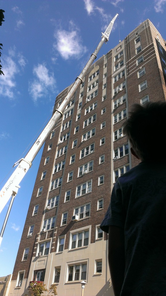
“Pine Street is closed today until 4pm between 47th and 48th as a crane replaces two cell phone cabinets.  The crane is extended to 237 feet, quite a distance above the 14 stories because the cabinets are 60 feet from the edge of the building.  The replacement cabinets are en route and are scheduled to arrive around 10:30. The sidewalk and businesses are open.”

Cell phone tower on Pine Street

Photo by Joel DeGrands

Comments (1)

Trolley tunnel to close for a week beginning August 2

July 24, 2013

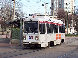
septaroute36SEPTA announced today that the trolley tunnel to and from Center City will be closed from 10 p.m. Friday, Aug. 2 until midnight on Monday Aug. 12. The 11, 13, 34 and 36 trollies will reroute to 40th and Market Streets where passengers can connect with the Market-Frankford Line, which will not be impacted by the tunnel work.

Shuttle buses that are currently being used along the Route 10 line will run to 40th and Filbert Streets during the repairs instead of 33rd and Market.

SEPTA crews will spend that week replacing overhead wire and doing ceiling work in the tunnel, according to a statement.

“We use the tunnel almost 24 hours a day, which means we have very limited opportunities to obtain track outages for extensive repair work,” SEPTA’s deputy general manager Jeff Knueppel said.

Editor’s Note: The trolley tunnel shutdown starts at 10 p.m. on Friday, Aug. 2., not at 10 a.m. as originally stated in the post.

Comments (4)